Williamsburg, locally called “the Burg,” is located on the Boone’s Lick Road.
Location
The small unincorporated community of Williamsburg is located about 13 miles northeast of Fulton on Old U.S. Highway 40/MO Highway D, just north of Interstate 70. The USGS coordinates are Latitude 38°55’05”N Longitude 91°42’06”W. The Atlas shows it in Twn 48N, Rng 7W, Sec 21.
Settlement
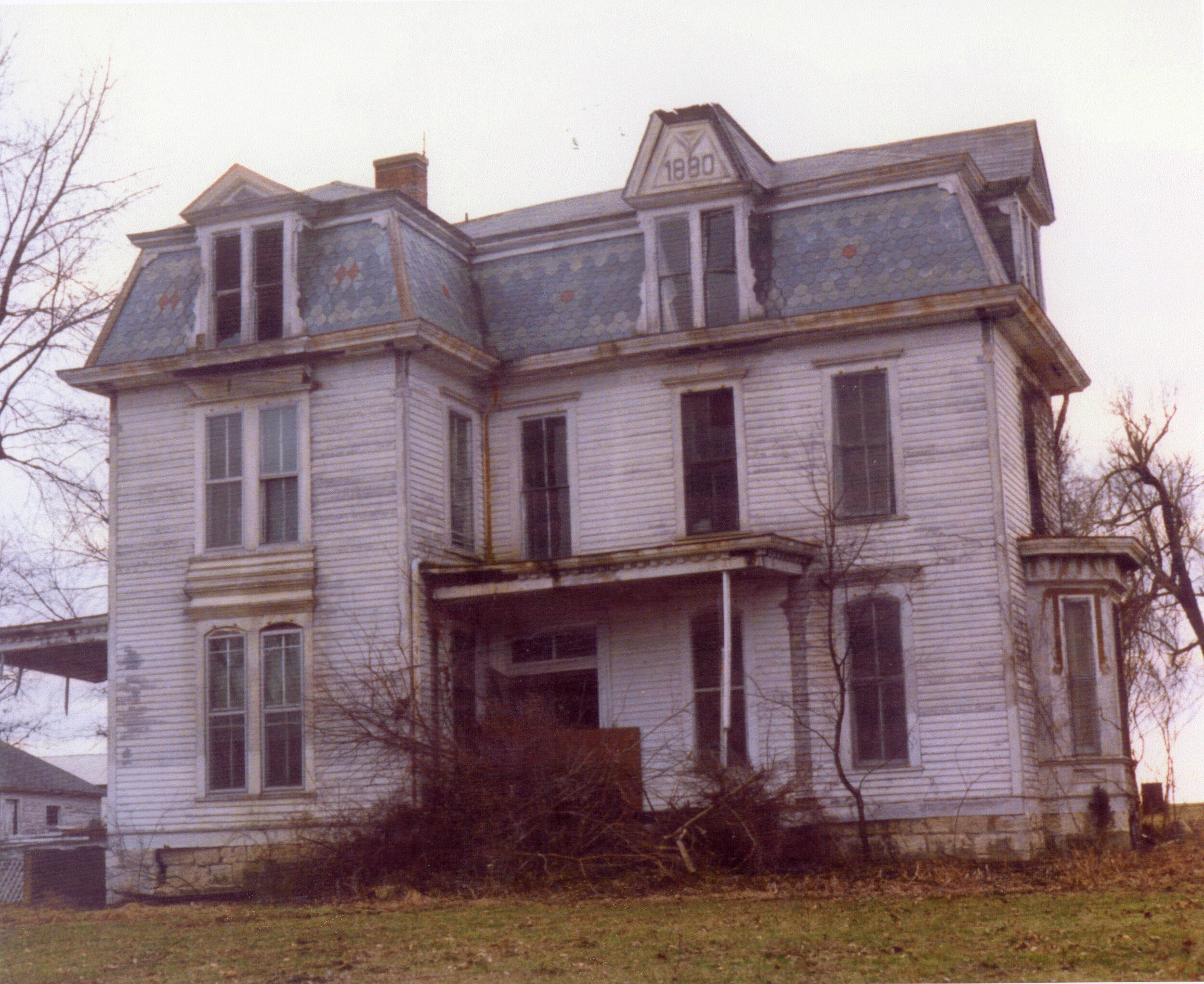
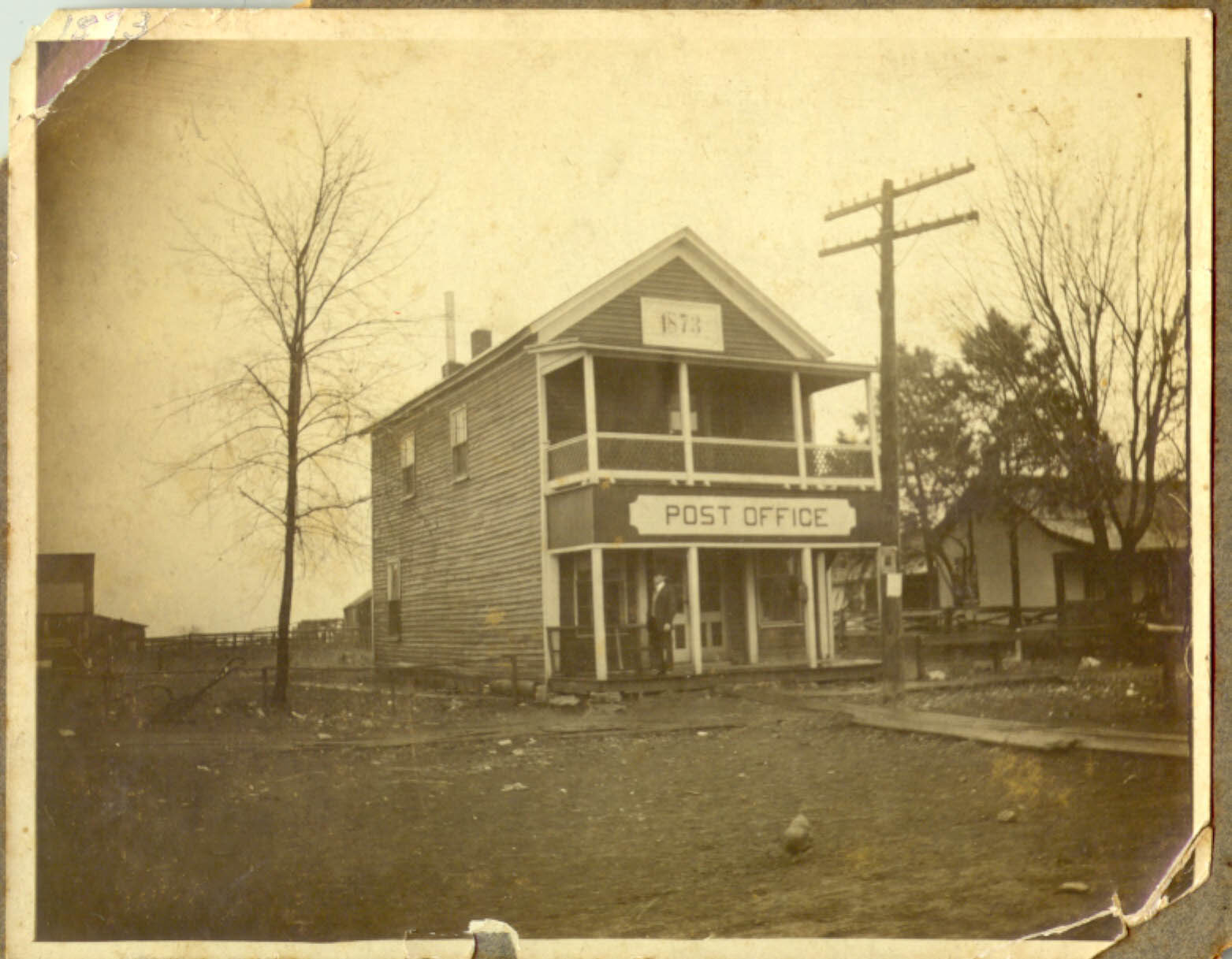
The earliest settlement on this site seems to have been “Fruits,” which had a post office established on January 4, 1828. On September 28, 1835, the Fruits post office was closed and another was opened under the designation of Williamsburg. According to tradition, Williamsburg was actually laid out some two years after it was founded. Courthouse records date the plat from December 1, 1836. B.G.D. Moxley, a partner of Harvey Williams, and a man named Compton are credited with laying out the town. They also operated its first store.
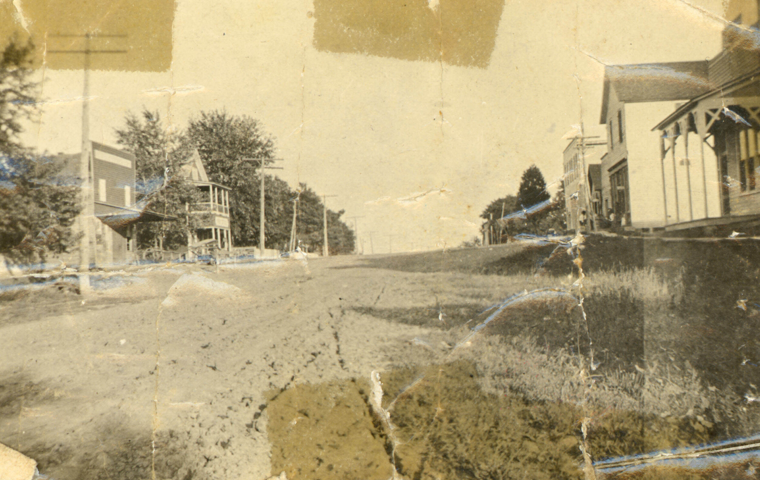
Williamsburg’s location was significant because of the difficult terrain due east of there. Loutre Creek and the nearby hills were a hazard for the heavily loaded wagons. Since the flat prairie west of Williamsburg offered little trouble to the frontier traveler, the little town soon gained prominence as a provisioning point. Today, despite relocation, the main St. Louis-Kansas City highway continues to run nearby. With easy access to and from U.S. Interstate 70, Williamsburg continues to get considerable trade from the traveling public.
Economy
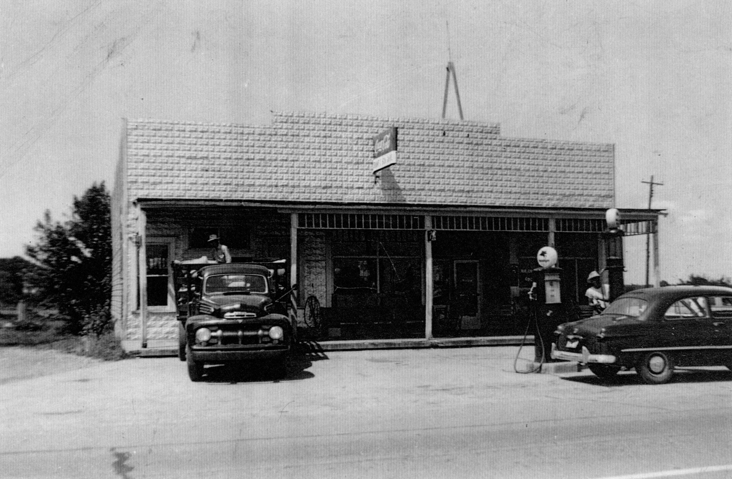
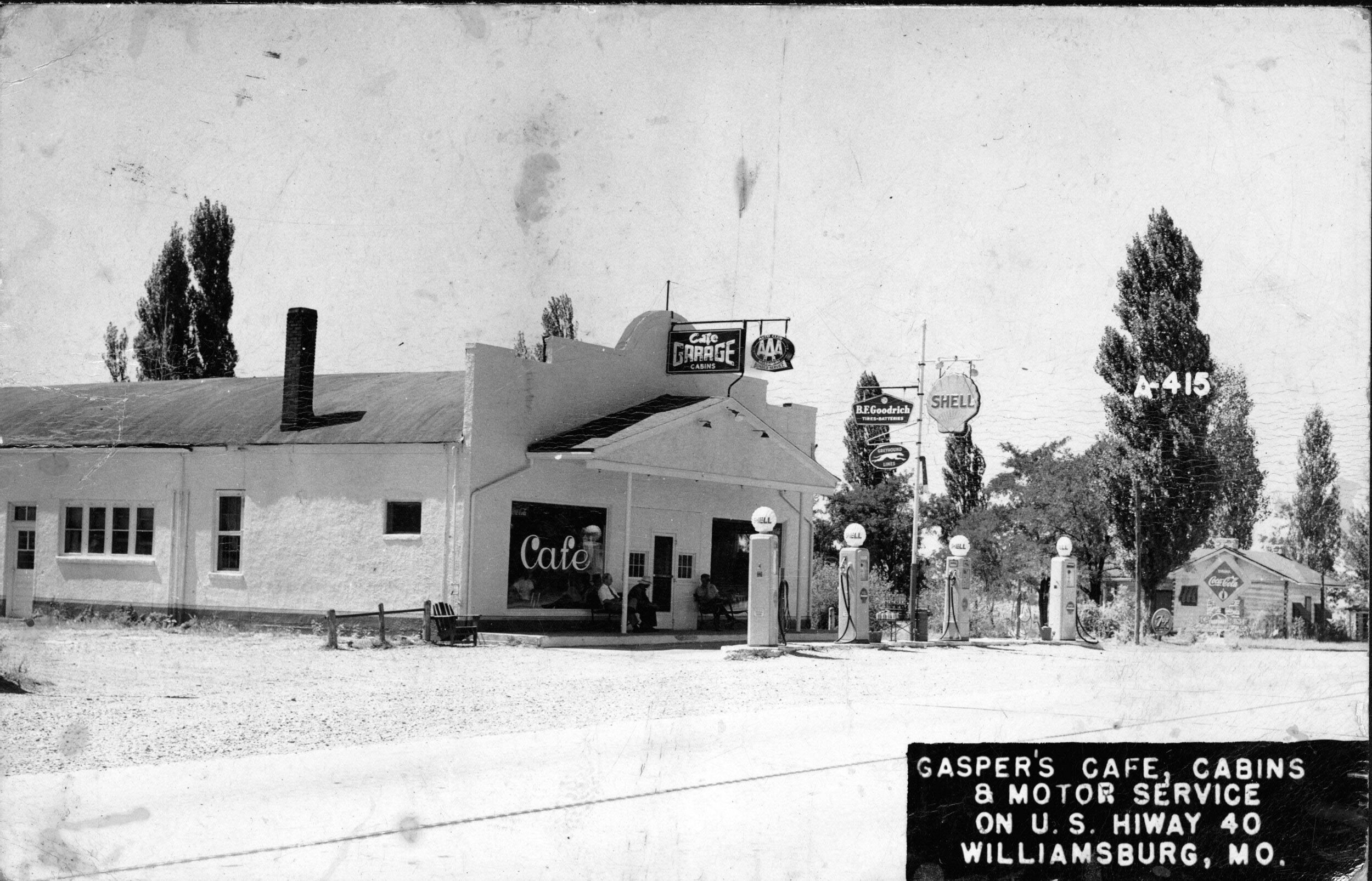
From 1880 until the 1930s Williamsburg was the trade center for the surrounding area. Groceries, hardware, clothing, farm supplies, as well as medical attention and drugs were all available locally. It is of interest to note that of all frontier businesses and professions in Williamsburg in 1884, only one still remains - the General Store.
There are a number of public and cooperative things that add to the town. Some of these are The Williamsburg Community Club, which is housed in the old Methodist Church building whose congregation had served the community from before 1884 until 1951; The North Callaway Fire District fire station; The Missouri Highway Department garage and maintenance shed for the area; The Old Auxvasse-Nine Mile Presbyterian Church; and the Williamsburg Post Office, which has served the area since 1835, despite its not being on a railroad.
Education
Williamsburg had two schools – a black school and a white school. In 1964, Williamsburg joined other small area schools to become the reorganized school district, North Callaway R-1, for the north part of the county. The Williamsburg Elementary School, with approximately 150 students, serves the surrounding area of Callaway County. Area students then attend North Callaway Middle School in Auxvasse and North Callaway High School in Kingdom City.
Today
In 1921, B.R. Crane of Mineola bought the T.V. Ham general store in Williamsburg and his son Sam Crane moved there to run the store. U.S. Highway 40 was constructed in 1926 and the Cranes built a new store building on the new road. In 1932 the only other store in town closed and since that time, Crane’s store has been a dominant force in the life of Williamsburg. In 2019, Crane’s Store celebrated its 130th anniversary in business, which started with the store in Mineola.
In 1976 the Missouri Conservation Commission purchased over 5000 acres north of town and developed it for recreation and wildlife conservation. This area, known as the Whetstone Conservation Area, is used for hunting and fishing. Each year it attracts more visitors.
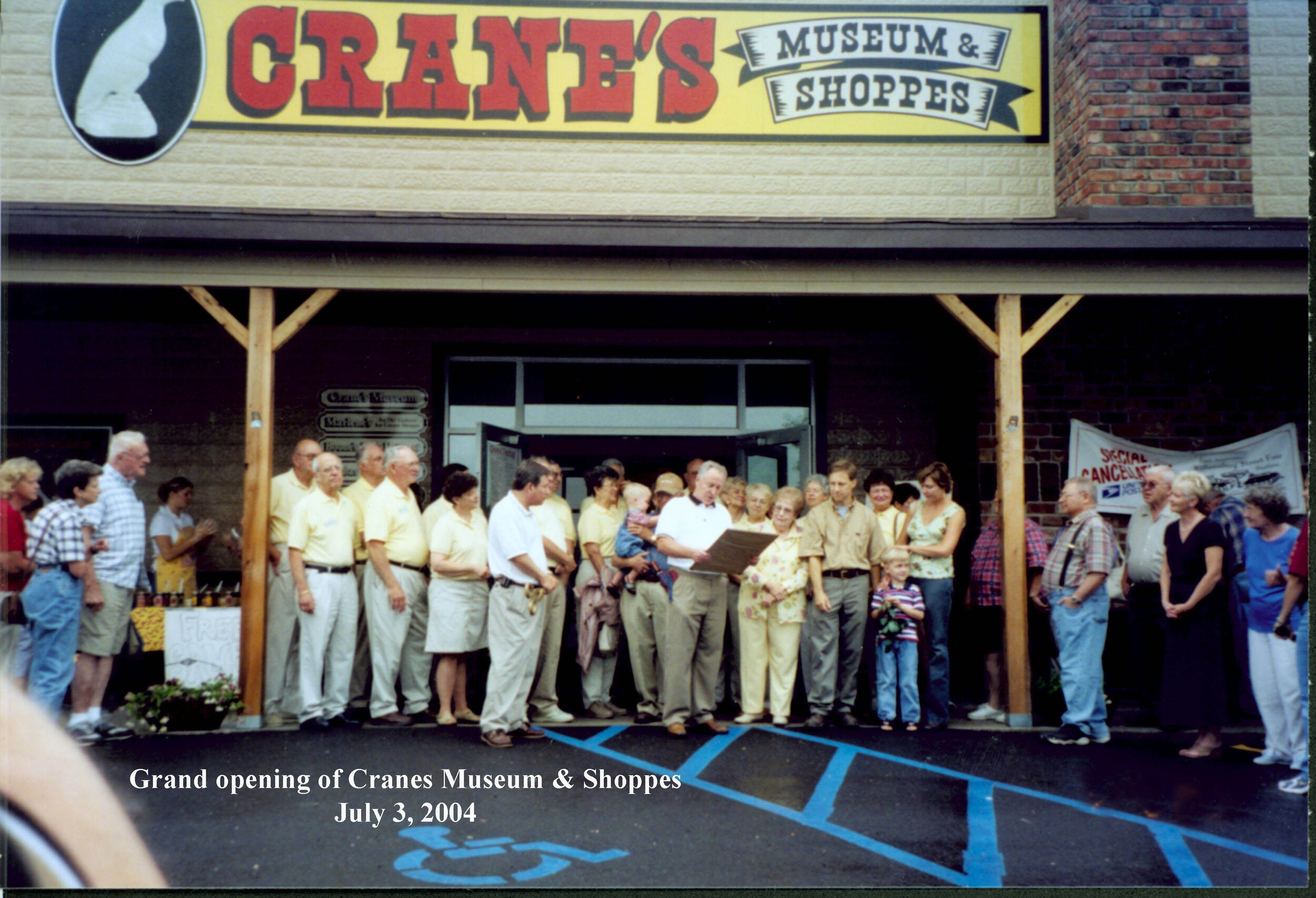
In 2004, Joe and Marlene Crane built and opened Crane’s Museum and Shoppes just west of Cranes Store. The museum complex displays four generations of Crane family collections and auction finds. It is also home to Marlene’s Restaurant which serves breakfast and lunch; a salesroom for closeout items from Crane’s Store; and Lynda’s Townhouse Treasures.
Compiled January 2021
For more information and resources contact the Research Center.
Williamsburg, Missouri
IMAGES OF Williamsburg, MISSOURI